
How to Create Powerful ArcGIS Online Workflows (Infographic)
ArcGIS Online is Esri’s web-based mapping platform that lets you instantly create and share spatial information. Below are a few ways to do even more with this powerful service, including...

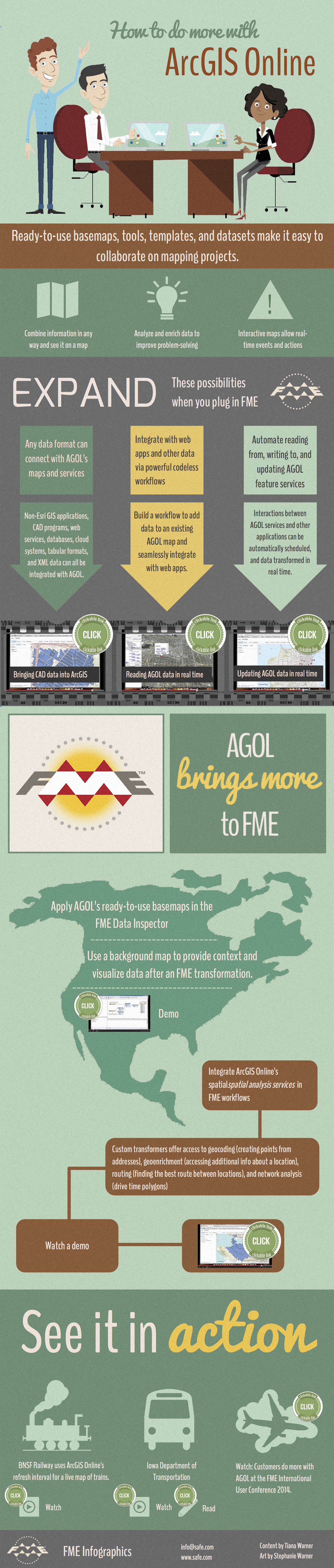
ArcGIS Online is Esri’s web-based mapping platform that lets you instantly create and share spatial information. Below are a few ways to do even more with this powerful service, including sophisticated data integration, workflow automation, and real-time updates.
| Click the videos in the image to see demos, or view the resources at the bottom of this post. |
Resources
Demo: Bringing CAD data into ArcGIS
Demo: Reading AGOL data in real time
Demo: Updating AGOL data in real time
Demo: Applying an AGOL basemap in the FME Data Inspector
Demo: Leveraging AGOL services
Video: BNSF Railway
Video: Iowa DOT
Blog: Iowa DOT
Videos and slides: ArcGIS Online at the FME UC
Explore more blog content headline

Getting Started with Cloud-Native Geospatial Data Formats

Data-Driven Marine Operations: 5 Ways to Generate Actionable Insights from Ship to Shore

Introducing FME Form 24.0: Redesigned User Experience for Focus and Consistency
Real change is just a platform away.
FME is ready to put your data to work and transform your business today. Are you?