FME World Tour 2013 – Live Blog


This post is a live-blog record of the FME World Tour 2013 event in Vancouver, which occurred on April 16th 2013.
To view in chronological order, scroll to the bottom of the page and work your way back up!
2:55pm: So Don and Dale finish off this presentation. Apologies if the live video was a problem. It was the exact same setup as last year, when it worked perfectly, so it’s baffling. Anyway, all of the video and presentations will be made available online.
So, a final thank you if you stuck with me and read all of this, and goodbye!
2:53pm: Time to wrap up. Thanks to everyone who attended the tour in person or online. It’s been great to meet you all and get involved with all our customers. The tour continues now in South America, Europe, Australia, etc. If you are in one of those locations, please do attend if you can.
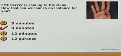
2:49pm: Notice that there is a sci-fi theme for at least one incorrect answer. By the way, the answer is always “A” for questions that come from other tour venues. I thought only one would ever be shown at one venue, so it didn’t matter. I thought wrong.
2:45pm: I think prizes are being handed out for answers, right or wrong! The original answer to the “how fast can we launch an online Server” was four minutes, hence the reason for the image clue.
2:35pm: Be sure to stay tuned to the opening slide for the quiz. A great blend of animation and sound effects!
2:32pm: Coming up next is a fun quiz to wrap up the day. I got to make it, so it was fun for me anyway. It started out as a Family Fortunes (Family Feud) game that was presented at a reseller event. Now it’s more a multiple-choice quiz. There was much hilarity when we used this on tour.
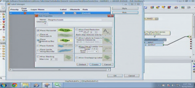
2:27pm: The configure dialog in this transformer is like nothing else in FME – in a good way!
2:26pm: Now Dale presents the MapTextLabeller. It is extra-cost, but it does have a lot of value to the right people (Dale says that, but I strongly agree).
2:24pm: There’s a bit of fudging going on now for videos to be made of the presentation. That’s my segue into the fact that these presentations will be made available afterwards – so if your video feed froze, don’t worry.
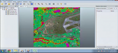
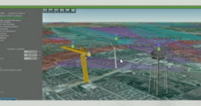
2:22pm: He’s using a custom transformer (not one that is on the FME Store). The result looks like this. Purple shows the highest points. These are the areas of concern:
2:21pm: It’s Lidar (Point Cloud). Here we are trying to extract info from the point clouds – to add value to it as Dale says. Dale is trying to find out where tree heights are above a defined level. I think it will be interesting if he is able to pick out trees in this way. Let’s see.
2:18pm: That really was lightning. Dale is now going to demo either the MapTextLabeller or Lidar functionality (maybe both).
2:17pm: As Mark mentions, it’s important to get the order of the tests correctly, especially when you are cleaning the data. You might want to clean the data in one way, before you clean it in another. So the list of tests is “reorderable” to let you control this.
2:15pm: The example Mark is showing now comes from our Desktop training course.
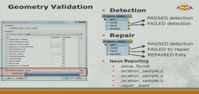
2:12pm: I find this transformer useful for cleaning up the basic geometry integrity of data. It’s especially useful when you have a writer or transformer that rejects data (maybe errors or crashes). When I get a failure like that the first thing I do now is check the very basics of the geometry. It will check whether the data is corrupt (what we call “degenerate”) and fix things that are obviously bad; for example is it a 2-point polygon? A single-point line? Is there a NaN coordinate? These are the things that are basic enough that anyone should want them fixed.
2:10pm: Mark Stoakes is now going to talk about Geometry Validation. You probably know we have a new GeometryValidator transformer in 2013. It replaces a set of transformers (eg OGCValidator, SelfIntersector). But one other advantage is that the transformer can be set up to either validate data by itself, or also clean it up. Some users will want to do one, but not the other.
2:08pm: Incidentally, all of the FME Server demos shown on the World Tour are built on an FMECloud setup.
2:03pm: Stewart has now absolutely promised that FME Server 2014 will include WebSockets. OK. He said probably. But I think I’ve seen it committed to the product already, so I’m hopeful.
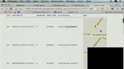
1:59pm: I’m having technical problems, but they could be mine as much as the feed. Stewart is showing a demo you may have seen previously. He is emailing a dataset to FME Server in order for Server to carry out QA on it. You’ll also be able to find this demo on YouTube:
1:53pm: I think FMECloud will be great for startups looking to get an idea off the ground at minimum cost. I already have a few ideas for FME Server in the cloud. But then you probably guessed that!
1:49pm: For security, FMECloud is based on Amazon Web Services (AWS) so includes all their security. I’d also think that the actual data doesn’t need to be loaded on that machine. You could host your data wherever, as long as that machine can access it. And, as Stewart mentions, it can be more secure than opening up your own systems to outside users.
1:47pm: For FMECloud you also get to choose the size of the machine and the number of engines. Stewart explains that at this point the exact numbers are still liable to change. But basically you can start up an engine, run it for 24 hours for a specific job, then shut it down again.
1:43pm: Next up, Lightning Talks. Stewart Harper is up first to talk about FME Server updates for 2013. FMECloud.com is the big news. It’s a service where you can launch FME Servers online and we manage the upkeep of them. Because it’s on-demand, there’s no big cost upfront. It’s like a pay-as-you-go phone.
1:29pm: A custom transformer called the PDFLayouter is what powers the layout of the data (scaling, rotation, and offset). It also writes the frames, legend, etc for the layout.
1:27pm: Jonathon explains text labelling was the biggest challenge. His FME Server delivers data through the Data Streaming Service. Workspaces on Server are executed using JavaScript in a web mapping application.
1:23pm: Jonathon explains how the PDFs were created. FME Server was chosen to be a scalable and stable solution. I know from experience that PDFs can be made to look absolutely stunning – but it can take a bit of effort to implement. Jonathon calls it “a challenge” and his workspace shows this sort of complexity.
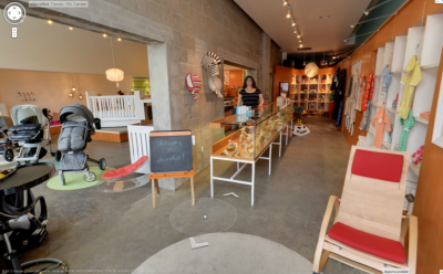
1:19pm: On the subject of floor plans, I just found out yesterday that Google now has StreetView inside buildings. I’d heard this might be coming soon, but didn’t realize they were this close to implementing it. Impressive. Anyone know if they will do this for all buildings? Do the building owners request them to do it? I wonder how that all works.
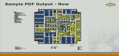
1:18pm: Here’s what their PDF output looks like:
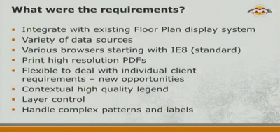
1:12pm: The rationale for FME is that their existing system does not produce the quality of PDF required for floor plans. Their requirements are thus:
1:08pm: Jonathon starts his presentation. i-open is based in Abbotsford, BC. Steve is apparently from Jones Lang LaSalle in Texas. They are a real estate professional services firm. They have 40,000 employees around the world.
1:05pm: Mark Stoakes opens the proceedings by mentioning the Transformer Guide in everyone’s handouts. This is a great document and you can get it online on our web site.
1:01pm: My wife is upstairs watching A Knight’s Tale. Down in my office it sounds like I’m listening to the soundtrack. This is very medieval muzak being played while we wait.
1:00pm:The tour will start again shortly. The live feed is behaving nicely for me now. The first session this afternoon is billed as FME Server for High Quality On-Demand PDF Printing. It’s a user presentation by Jonathon McIntyre and Steve Bogart of i-open Tech.
12:10pm: On James Fee’s feed they were asking how many attendees were in Vancouver. I believe there were over 100 registered. You probably can’t see that though, from the picture.
12:07pm: Sorry, I missed a bit because of a dodgy connection. It’s lunch now. I’ll be back in 1 hour.
11:59am: Now we’re onto the MapTextLabeller transformer, and how it can be used to label the Tesla route map.
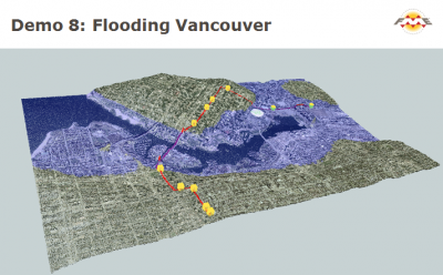
11:58am: There’s a quick demo of Lidar data now, and how it can be used and manipulated. The scenario is a flood in the City of Vancouver:
11:54am: D+D now showing how FME can read data from zip files now, and also data from files online. In this case they are reading food cart data directly from a zip file stored on the City of Vancouver ftp site. Then this data can be fed into the Tesla workspace to alert the driver when they are close to a food cart (SMS or Email)
11:52am: Dale shows how the GeographicBufferer can be obtained from the FME Store simply by placing it within Workbench.
11:50am: Because Salesforce is non-spatial, D+D will have to geocode from addresses. DMTI have a geocoder included in FME now (extra-cost). Don’s fave transformer is the GeographicBufferer. You can buffer lat/long data in metres – but I bet it still doesn’t buffer on the ellipsoid (over the poles/dateline). I’ve been talking with our coordsys developer about how we might do that – we’ll have to see if that idea takes off.
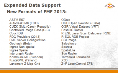
11:45am: This leads D+D into a discussion of new formats in FME2013. My fave is probably Geohash, but I also like PostGIS Raster, Socrata, and SpatiaLite.
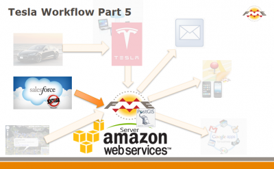
11:44am: Now Dale is looking for “points of interest”. For example, while driving he might want to know when a charging station is close (and if his battery is <40% for example). In this case he is looking for FME customers in the area, by pulling that information from Salesforce – the cloud database we store corporate info in and which we now have a reader and writer for.
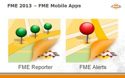
11:35am: Don is sending out alerts now, based on where the location of the Tesla is. It’s a form of geo-fence. If you have the FME mobile apps you can connect to his FME Server and receive notifications based on the Tesla (when it is within 20km). The way that users subscribe, and the FME Workspace it runs, is something I’m fairly unsure about. I shall have to investigate that a bit more (and share it with you too, of course). Dale shows the list of followers. I saw a dot in my location. Can you send the car out to Winnipeg so I get an alert?
11:32am: Sending out an email is fairly simple. You just have a set of keywords that are sent to FME Server. FME Server inserts the keywords into the email and sends it out.
11:27am: I have video again. Dale and Don are inspecting notifications and how they are set up in FME Server. Now Don has a workspace that issues a daily report on Dale’s car and where it’s been. It would help stop the valet abusing his privileges, like in the Ferris Bueller movie. NB: Neither of these guys are Ferris Bueller. They wouldn’t have been able to do this if Ferris had had FME:
11:18am: Yikes, I just accidentally shutdown my web feed window, and can’t get back in. So I’ll have to skip the next part!
11:17am: Data is passed in a JSON format. JSON is described by Dale as the language of web services.
11:13am: So FME reads data from the Tesla API and writes it to PostGIS. Like they mention you could use Azure instead. The data is going through FME Server which has a topic set up to be triggered by events. The car PUSHes data to Tesla, but we have to PULL it from there, so we aren’t really responding to an event, but it’s as close as we can get. We can get lat/long, speed, heading, battery charge, etc.
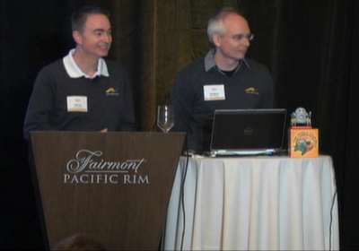
11:07am: I’m fairly peeved about this. I thought my Mini Cooper S was the coolest car in the Safe car park… but I think Dale’s Tesla beats me. Oh well.
11:06am: So the demo now is going to be based on sensors and internet feeds. In this case the Tesla car’s Rest API will provide the data. As other examples, Dale mentions the Nest thermostat, which I really want to get. Sat in a bar last week with Don he could look up his home CO2 concentrations on his phone, so he doesn’t just talk the talk, he walks the walk too!
11:03am: Don and Dale discussing performance improvements in FME2013. As always we only release FME when it is faster. A slower FME test is a bug.
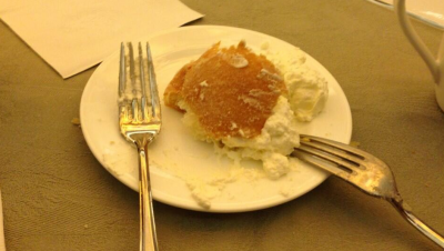
10:59am: Apparently attendees are getting Swedish “Semla” during the break. From the attached photo I’m guessing it’s a type of food! In Winnipeg we got cannoli. It reminded us of the line from the Godfather: “Leave the gun. Take the cannoli”.
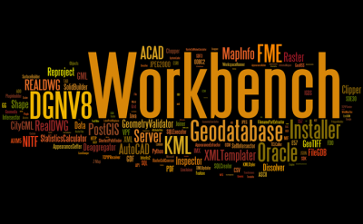
10:55am: We’re running this “Safe Hits the Road” presentation because there are just too many updates to 2013 to do the usual New in FME presentation. There were 741 items in the What’s New list, and someone came up with a Wordle of their subjects:
10:45am: I hear the video stream is back in action…. just not for me yet. In Vancouver they should be restarting soon with a segment called FME 2013 Hits the Road. It showcases new functionality in 2013-SP1 by taking data from Dale’s Tesla car via its Rest API.
10:30am: If they are sticking to schedule in Vancouver then it will be time for a coffee break. So I will take a break too and come back in 15 minutes. Hopefully by then the video feed will be back in action.
See you shortly…
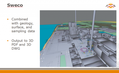
10:28am: I’ll also mention this project from the presentation. You may have seen it before. It is the creation of a 3D model to help decommission a 70’s era nuclear plant in Sweden. If I recall correctly one challenge was for users to record location inside the building (where GPS won’t reach). The solution was to create QR codes that represent spatial coordinates. The users would draw on a map containing QR codes which was then scanned into FME which could interpret the codes and geo-reference the data. Very cool.
This uses one of my favourite formats: 3D PDF. I know PDF is not fashionable or trendy, but for 3D data I think it’s hard to find something that is so useful and so portable.
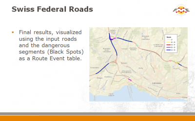
10:23am: Another project I’m sure they will highlight (and this too was a project submitted for FME Certification) is an analysis of traffic collisions in Switzerland. This is a Linear Referencing project that used FME to accumulate accident info for each section of road and apply weighted scores. This enabled them to create a map of dangerous sectors (black spots). They used Python for parts of this, using the PythonCaller transformer:
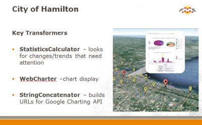
10:17am: And another… the City of Hamilton (Canada) using FME for public health purposes (tracking the spread of West Nile Virus). They use the StatisticsCalculator (which has had some great updates for 2013-SP1 by the way), the WebCharter transformer, and the StringConcatenator:
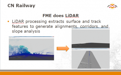
10:13am: Another project. CN Railway (of Canada) using FME to process LiDAR data.
Apparently FME is also used for real time event processing (FME Server via a Websphere Messaging setup) and for handling 7m points of GPS data per hour, plus an AutoCAD Map3D to MapGuide translation.
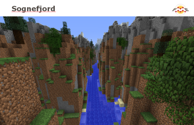
10:08am: A “bonus” project that I haven’t seen before (I’ve downloaded the slides and am looking at them) is labelled “The first combined land/sea terrain model of Norway!”. It looks like someone’s been using FME with Minecraft to me!
10:04am: Another project we’re highlighting (and another certification project I think) was using FME Server to monitor waterways in Europe. I believe the clearance spaces under bridges were measured, and boats travelling down the river equipped with sensors and mobile devices. FME Server would read the sensor info and issue an alert if it looks like the boat might have a problem passing under the bridge.
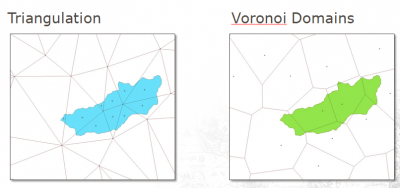
9:58am: Another project was from Takashi Iijima of Pragmatica Inc in Japan. He was using FME to help analyze cesium concentrations in agricultural water, in the wake of the Fukushima disaster. This was another certification application, and probably the best project I’ve seen (well designed, functional, easy to understand).
Takashi used several methods to analyze the sampling methods by using different boundaries, including Delauney triangulation and area-weighted results. He started out with an Excel spreadsheet of data and so had to first convert it to spatial.
9:55am: While we are blind I’ll try to recall the other use cases we are presenting. One is for land classification of raster data. This was a project we received for FME Certification from a user (Ana García de Vicuña Ruiz de Argandoña) in Spain. She basically took raster aerial images and used various equations on them in FME to figure out different classifications. I really liked that one. It was a great project and quite unique for FME.
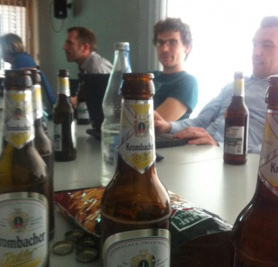
9:50am: With the feed down (I hear it should be back shortly) viewers worldwide find that it’s time for a beer:
9:45am: And with that my video feed reverts to a recording pre-event. There’s some nice acoustic guitar music, but that’s not really what we want to hear. This is such a shame after last year’s went so, so smoothly.
9:42am: Mark talking about San Antonio Water. I assume it’s based on this case study. They make good use of Custom Transformers he says. He says there are 50+ QA checks on the data, and two different systems are being kept in sync with FME.
9:40am: The Austrian folk had moving simulations. Dale showed a video of a simulated train. I was talking with users in Winnipeg about location-enabled video earlier last week. I think it’s something we could actually look at implementing in FME.
9:36am: Dale now talking about an Austrian customer who run simulations and do QA. FME is used to assemble the data. I missed the intro but I think it must be 3D data for visualizing proposed developments.
9:35am: Apologies for the feed problems. I’m afraid I don’t have an alternate URL. Not sure why it is working for me and not you, but I guess it’s a good job I can see!
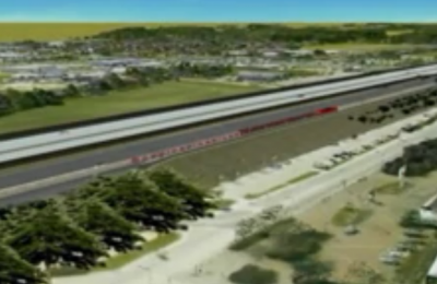
9:32am: The first user example is a system that lets you determine whether a new development will impact on public airspace. I recall there was an example in a previous FME conference for Las Vegas. This one is in Kansas (DOT). I like this because it’s an online tool that anyone can access and use.
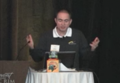
9:30am: Next segment is an Around the World tour of FME stories. There are some excellent examples in here. Dale comes on stage and gets very animated:
9:27am: As Mark mentions, we have the File Geodatabase API reader/writer. This was in 2012 but I know not everyone knows about it. If you want to switch from the true Esri format to this, then you’ll need to add a new Reader/Writer. It won’t change automatically. A user in Winnipeg asked about this very issue.
9:25am: Mark mentions a new update to the Joiner dialog. I mentioned this in my Sneak Peek preview of 2013
9:21am: Mark is talking 2013 now. The Data Inspector replaces the FME Universal Viewer. It has this great table view dialog. Way better than the previous FME Viewer, which was limited to one record at a time. Look under Tools>FME Options in Workbench for a setting to switch from one to another. Here’s what the table view looks like (click to enlarge):
9:18am: The Marketing team are panicking now, wanting to know what I can see! I get Mark live on video, but his slides are not appearing. He is now talking about the MapTextLabeller transformer. We did a webinar on this (see our webinars page). It produces some fantastic results. There will be more on this later.
9:16am: Mark talks about moving the interface to a new technology. This is enabling us to support FME on Mac and Linux (for 2014 we expect). Also, dialogs will be more intelligent.
9:12am: The FME build in use today is 2013-SP1. Apparently we’ve cracked the 300 barrier for the number of formats this time around. This time last year is was 278.
9:11am: Mark Stoakes (head of Pro Services) is introducing FME Desktop today for any new users. There is a cheesy intro video. As mentioned, we blew the budget on lunch, not the movie. Serious stuff now. Mark explains the different fields FME is involved in – including non-spatial, which is a growing area.
9:07am: The goal today, we’re told, is to have fun – because it’s better when folks are awake! Can’t argue with that. The Zipster giveaway is a robot figurine. Yes, the arms are prone to drop off.
9:06am: We’re now starting. Thanks for the shout out Dale. And folk please feel free to add comments, send me email questions, etc.
9:04am: The live feed is now playing a Moody Blues track. I hope they don’t start too quickly! I like this one.
9:02am: Yesterday I asked what device you would like to get live updates from in FME. A great answer was from gun dog tracking devices. I assume you could analyze their tracks for training purposes by keeping a record of it. Thanks to @geometadata for the suggestion.
8:58am: The event is getting ready to start. I can see on the live camera a table of Safers including Don (President), Craig (Sales), Stewart (Pro Services)
8:30am: Good morning everyone. As the FME World Tour hits Vancouver today I’m live blogging the event here. Don’t forget, you can also:
- Sign up for the live video stream
- Tweet and retweet using the tag #fmewt

