The value of spatial data and spatial databases expands beyond maps and visualization. Spatial data is another type of information that drives smart decision-making for your enterprise. With spatial data, you can make better decisions and improve analysis. Spatial data (also known as geospatial or geographic data) is a term used to describe data containing information about a specific location or area on the earth.
Spatial data provides a competitive advantage to your organization. Now and in the near future, spatial data is becoming critical. The decision making systems in generations to come will leverage the vast amount of spatial data coming from 5G, sensors, and the Internet of Things (IoT).
The basics and examples of spatial data
As creators of FME, the only enterprise integration platform with comprehensive spatial data support, we work with spatial data and databases constantly. With our experience and expertise, here is our take on 7 spatial databases that you should consider for your enterprise. Before that, we will also explain why you should embrace and understand the value of spatial data, sooner than later!
The Value of Spatial Databases
Spatial data does not add another layer of complexity to your data, it adds value. In this blog, we will cover:
- The basics of spatial data, spatial databases and how they are used in business
- What are common spatial databases and seven spatial databases you should consider for your enterprise
- How the FME ETL and enterprise integration tool integrates spatial data seamlessly across your organization
Learn more about the differences between spatial and non-spatial data
Learn why spatial data is important
What are Spatial Databases? Why are Spatial Databases important?
Spatial data is diverse. Over the years, spatial data has grown. Now, spatial data covers everything from simple vector data (points lines, or polygons) to imagery, complex 3D scenes, and even indoor locations. Representing real-world objects with accuracy or performing analysis can be quite complex. This is why we need spatial databases (also known as geospatial databases).
Spatial databases are built to store and provide powerful query capabilities for spatial data. Spatial data is often much larger in size than traditional data because of its additional locational component. Spatial databases make the storage of complex spatial data possible. Traditional database management systems are not capable of storing, querying, and indexing spatial data.
You can find spatial databases supported natively through a database (i.e. Microsoft SQL Server), or as an extension to an existing database (i.e. the ever-popular and powerful PostGIS extension for PostgreSQL).
 Source: https://africansurveyors.net/
How do Spatial Databases differ from each other?
When it comes to comparing spatial databases, we can look at three primary features:
- Spatial data types
- Spatial queries
- Spatial indexes
Together, these three components comprise the basis of a spatial database. These three components will help you decide which spatial database is most suitable for your enterprise or business.
Spatial Data Type
Spatial data comes in all shapes and sizes. All databases typically support points, lines, and polygons, but some support many more spatial data types. Some databases abide by the standards set by the Open Geospatial Consortium. Yet, that doesn’t mean it is easy to move the data between databases.
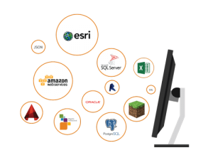
This is where the FME platform reveals some of its strengths. Database barriers no longer matter, as you can move your data wherever you want. With support for over 450 different systems and applications, it can handle all your data tasks, spatial and otherwise.
FME platform supports over 450 different systems and applications
Spatial Queries
Spatial queries perform an action on spatial data stored in the database. Some spatial queries can be used to perform simple operations. However, some queries can become much more complex, invoking spatial functions that span multiple tables. A spatial query using SQL allows you to retrieve a specific subset of spatial data. This helps you retrieve only what you need from your database.
This is how data is retrieved in spatial databases. The spatial query capabilities can vary from database to database, both in terms of performance and functionality. This is important to consider when you select your database.
Spatial queries drive a whole new class of business decisions retrieving requested data efficiently for your business systems.
Spatial Indexes
What does the added size and complexity of spatial data mean for your data? Will your database run slower? Will large spatial databases be too bulky for your database to store?
This is why spatial indexes are important. Spatial indexes are created with SQL commands. These are generated from the database management interface or external program (i.e FME) with access to your spatial database. Spatial indexes vary from database to database and are responsible for the database performance necessary for adding spatial to your decision making.
With that remark, what are some of the popular databases that support spatial data? What are the differences between these spatial databases?
Spatial Databases for Your Enterprise
Data is shared, expansive, and bulky. Here are some common spatial databases, and why you should consider them for your enterprise.
1. Esri Geodatabases
Geodatabase is the enterprise storage solution from the largest GIS vendor Esri; the industry leader in spatial data! Geodatabases were first touted as a simple geometry storage model for Esri users. Now, geodatabases have the capacity and capability to store virtually all types of geographic datasets. From vectors to rasters, point clouds and 3D, Esri’s Geodatabases can handle it all as the industry leader when it comes to spatial data.
 Source: Wikipedia
Geodatabase functionality is a database layer that sits on top of several different enterprise database management systems. This includes Oracle, Microsoft SQL Server, IBM DB2, and PostgreSQL.
This empowers spatial databases in an Esri-focused package. Geodatabases also utilize the power of versioning, which allows multiple users to edit geometry concurrently without running into conflicts. If you are using ArcGIS or ArcGIS Pro as your primary spatial analysis software, then geodatabase is a clear choice for you.
Learn more about the differences between Geodatabases and Geospatial Databases
| Type of Support | Extension |
| Spatial Data Types | Feature classes: points, lines, polygons, annotations, dimensions, multipatches, Raster, Point Cloud and 3D Objects |
| Spatial Data Formats | ESRI Data Interoperability Extension |
| Spatial Index | Database dependent or ESRI |
| Spatial Queries (Functions) | MySQL or PostGIS dependent or ESRI Standard |
Learn how to integrate Esri Geodatabase using FME
2. PostGIS
PostGIS is one of the most well known and complete spatial databases around. It is an extension to the open-source database, PostgreSQL.
 Source: Wikipedia
There is a plethora of documentation available about the PostGIS extension, adding specialty geometry data types. This includes point, line and polygon formats that anyone working with spatial data will be familiar with.
With support for over 600 spatial functions, PostGIS continues to build upon its expansive spatial database structure. If you’re looking to start experimenting with spatial databases for your enterprise, then PostGIS couldn’t be a better place to begin.
| Type of Support | Extension for PostgreSQL |
| Spatial Data Types | Point, Linestring, Polygon, MultiPoint, MultiLineString, MultiPolygon, GeometryCollection, Rasters |
| Spatial Data Formats | WKT, WKB, GML, KML, GeoJSON, SVG |
| Spatial Index | R-tree over GiST(Generalized Search Tree) |
| Spatial Queries (Functions) | 600+ |
Learn how to integrate PostGIS using FME
3. Snowflake
Designed purely for the cloud, this unique Data Warehouse as a service platform holds the power to bring all your data together. On this platform, your data is ready for analysis at any scale, on any cloud platform you desire. Amazon AWS? Microsoft Azure? Google Cloud Platform? Choose your flavour, cloud compatibility is no issue with Snowflake.
 Source: Snowflake.com
The native Geography data type means your spatial data is easily stored and queried with the Snowflake platform. If you’re looking to grow your enterprise even further, Snowflake’s Data Marketplace expands your possibilities for business intelligence and analytics.with access to over 800 live data sets from providers around the world, including spatial data.
| Type of Support | Native |
| Spatial Data Types | Point, MultiPoint, LineString, MultiLineString, Polygon, MultiPolygon, GeometryCollection, Feature, FeatureCollection |
| Spatial Data Formats | WKT, WKB, EWKT, EWKB, GeoJSON |
| Spatial Index | – |
| Spatial Queries (Functions) | 50+ |
Learn how to integrate Snowflake Spatial using FME
4. Oracle
Are you familiar with the Oracle suite of databases and database tools? If you already have your hands on an Oracle database, this might be what your enterprise needs to bring your data to the next level.
 Source: http://softwareengineeringdaily.com/
Oracle Spatial permits spatial data compatibility. It is included in Oracle’s converged database by default. Similar to PostGIS, Oracle Spatial provides support for more than just vector data. If you’re looking to implement topological data, or even 3 dimensional data types (i.e. TINS, Point Clouds, or LiDAR), then Oracle Spatial might be the right database for you.
| Type of Support | Native |
| Spatial Data Types | Point, Line, Curve, Polygon, Surface, Collection, MultiPoint, Multiline, MultiCurve, Multipolgyon, MultiSurface, Solid, MultiSolid, Rasters, Point Clouds |
| Spatial Data Formats | – |
| Spatial Index | R-tree |
| Spatial Queries (Functions) | Info here |
Learn how to integrate Oracle using FME
5. Microsoft SQL Server
Spatial support comes with Microsoft SQL Server, supporting a variety of data types. Vectors are the main focus of this spatial database.
 Source: https://cpl.thalesgroup.com/
It’s important to note that SQL Server supports two spatial data types (geometry and geography). Why have two data types? The geometry data type represents data in Euclidean coordinates. Whereas, the geography data type uses a round-earth coordinate system. In most cases you’ll find yourself using the geometry data type as it performs faster and supports 2D data.
| Type of Support | Native |
| Spatial Data Types | Point, LineString, CircularString, CompoundCurve, Polygon, CurvePolygon, MultiPoint, MultiLineString, MultiPolygon, GeometryCollection |
| Spatial Data Formats | – |
| Spatial Index | B-tree |
| Spatial Queries (Functions) | 40+ |
Learn how to integrate Microsoft SQL Server Spatial using FME
6. Amazon Aurora
Amazon Aurora is a cloud-based spatial database. It can run MySQL or PostgreSQL open-source databases. You can easily migrate your databases to the Amazon Aurora platform and take advantage of their full suite of tools.
 Source: https://assets-global.website-files.com/
This cloud-hosted service means you can have all the functionality of a traditional enterprise database, cost effectively. You can also scale your database for larger capacities, or scale it down, easily with a cloud-based database for your enterprise. This saves you time and money.
| Type of Support | Cloud-based |
| Spatial Data Types | MySQL or PostGIS dependent |
| Spatial Data Formats | – |
| Spatial Index | MySQL or PostGIS dependent |
| Spatial Queries (Functions) | MySQL or PostGIS dependent |
Learn how to integrate Amazon Aurora Spatial using FME
7. SAP HANA
If you’re looking for a business-focused spatial database platform for your enterprise, look no further than SAP HANA Spatial. This database system is specifically designed for a business analytics focus.
 Source: https://www.suse.com/
Your business applications have the potential to become much more powerful with spatial data. The SAP HANA spatial database is unique. It provides access to business intelligence tools, unlike any other database (i.e. yield prediction, supply chain management, and calculating risk indices of natural disasters). If you’re an API frequenter, SAP HANA offers some interesting options such as the Surface API, Weather API, and Wildfire API to name a few.
| Type of Support | Native |
| Spatial Data Types | Point, Linestring, Polygon, GeometryCollection, CircularString, MultiPoint, MultiLineString, MultiPoint |
| Spatial Data Formats | WKT, WKB, EWKT, EWKB, Shapefile, GeoJSON, SVG |
| Spatial Index | R-tree |
| Spatial Queries (Functions) | 80+ |
Learn how to integrate SAP HANA Spatial using FME
Other Spatial Databases
The world of spatial databases is ever expanding; both the number of databases and the spatial support within the existing spatial databases! The seven databases we explored above are just some of the choices I wanted to highlight. If you’re interested in reading more about these other spatial databases for your enterprise, here are some noteworthy options that are compatible with FME.
| Name | Type of Support |
| MariaDB | Native |
| Teradata | Native |
| Snowflake | Native |
| Microsoft Azure SQL | Cloud-based |
| SpatiaLite | Extension for SQLite (Local file/system only) |
Non-Native Database Support in FME
Don’t see a database here that you want to use? You can extend FME’s database connectivity using the JDBC (Java Database Connectivity) format. Find out more here.
How does FME fit into all of this?
There are many spatial databases to choose from. Many spatial databases are limited to specific geometry types and coordinate systems. While many databases do support some ability to import or export data with other sources, this is best described as limited and inflexible.
In contrast, the FME platform allows you to connect with many services and applications, including spatial and non-spatial data services. FME makes it easy to transform your data to the correct schema for loading into your databases. FME also makes it easy to share other applications from your database. You can forget about data models and data types that are not compatible between applications and databases. FME makes it easy to manage data, connect to your databases and move your data so that it can be used with other applications such as AutoCAD, ArcGIS, and many others to support your decision making.
FME and Spatial Data Integration
With FME you can import, export, index, query spatial databases all you want. FME is the most comprehensive software for spatial data integration. Safe Software created FME with the idea that data should be easily accessible and mobile between applications – irrespective of systems and data types. This idea still lives on today, with support for over 450+ systems and growing. Whether your data is spatial or non-spatial, FME is unrivalled both in terms of system support and processing tools to ensure that you get the data you need, where you need it, for your enterprise.
Contact Us, Learn More
Drive your business forward with FME. The FME platform gives you access to all your data when, where, and how you need it to make data-driven decisions that will take your business to the next level.
Tell us your (data) challenges through a discovery call! We can figure out which spatial database is best for your enterprise and share how we have helped others like you tackle mountains of data!


