Looking Back on FME UC 2014


350+ data experts from around the world gathered at the Vancouver Convention Centre today to celebrate data. Day 1 of the FME International User Conference 2014 was full of zombie apocalypses, “learnings”, impromptu live cellphone demos, popcorn, and other fun of all kinds.
FME UC 2014: Day 1
Don and Dale Opening Keynote
Dale and Don opened the conference with the promise of a conference full of learning , 70+ user presentations, and the opportunity to network with other FME users and 100+ Safe staff. The FME Doctors and the rest of the Safe staff are here throughout the conference to listen, answer, and as Don and Dale said, “We want to understand what you do and take that information to make a better product.”
They went through a fun timeline of the last 20 years of Safe Software—all the way back to the first office headquarters at Dale’s house in Surrey, BC.
“If we look back,” said Dale, “we can inform the future.”
They discussed how, where, and why they started Safe Software—the data problem, and the S.A.I.F solution.
“We were convinced that S.A.I.F was going to change the world,” said Don. “We saw a problem and were amazed that nobody had tackled this problem in a serious way.”
When your product name comes from a 5min conversation at 3AM #FMEUC @SafeSoftware
— The Locationologist (@DARKspatialLORD) June 10, 2014
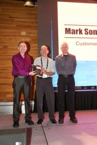
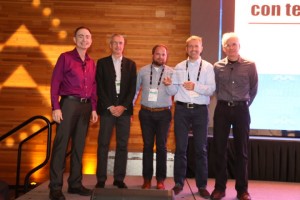
During the opening keynote, three customers were specially recognized with a complete collection of every spork Safe has ever made.
|
|
They also recognized the Safe team in this whimsical “Meet the Safers” video.
Don and Dale closed their opening talk with the message of celebrating users, people, partners, and the future of data.
Esri Keynote
Ismael Chivite, Senior ArcGIS Product Manager from Esri, kicked off the guest keynotes with a few live demonstrations of ArcGIS. He showed how easy it is to share GIS and maps with anyone and everyone—not just GIS professionals—whether the medium is a tablet, browser, or mobile device.
He got us excited about the present and future of mapping, and how easy it’s becoming to collaborate on projects of all sizes.
https://twitter.com/MapsRus/status/476407471901519872
Boundless Keynote
Paul Ramsey took the stage in an inspiring talk about “doing your learnings”. He proposed that Open Source provides opportunities to learn and expand your horizons, and showed how FME uses Open Source libraries to avoid reinventing wheels. He looked back to the beginnings of PostGIS and discussed potential for the future of open source.
“Expert users can be trapped by their own expertise,” he said. “They get blocked by their own learnings.”
He discussed how our tools define our horizons, and challenged us to always keep learning. We must think of data as a liquid, free to move around.
"Data is not a solid, it's a liquid" @pwramsey #FMEUC #learnings
— Guido Stein (He/Him) (@GuidoS) June 10, 2014
Paul challenged, “Learn SQL, Python, web services, cartography … learn something new, something hard, something uncomfortable.”
FME Whirlwind Tour 2014
We then took a whirlwind trip through some of the best FME user stories from the FME World Tour 2014.
Safer Aaron Koning talked about “the power of one” in a few Georgia Power geolocation use cases. Sometimes it just takes one transformer, one step, one workspace … or when it comes to SDF to SDE translations, one letter. He finished with this tip for learning FME: “Learn that one thing to achieve the business goal.”
David Eagle from 1Spatial discussed how FME helps automate data migration tasks, from controlling inputs through to validation and transformation. He concluded in saying “FME is helping Barnsley to deploy its slim resources efficiently.”
Ken Bragg talked about how Smart Cities need Smart Data. He gave an overview of how Lyon, France, uses FME. When it comes to Smart Data platforms, he defined a few strict requirements for real-time data—including not exceeding 10 seconds of processing time, and constant availability.
Dean Hintz discussed integrating data sources for flight planning, generating results that are easy to interact with.
Finally, Mark Stoakes discussed one FME newbie’s experience in a data conversion project from GIS to the Esri Local Government model. “She had the realization that data migration is more difficult than you think,” he said. “It’s always more work than you think in lining up data models with different systems.” Fortunately, she had FME to help. Mark reminded us that FME’s support team is always standing by to make these projects easier!
Pushing Boundaries with FME
The afternoon was full of great demos showing off what amazing things can be done with FME.
https://twitter.com/fmeuc/status/476460067651219457
We saw a zombie apocalypse scenario, where Michael Fitzpatrick set out to prove that FME Cloud can help us survive a zombie apocalypse. He figured if he can do that, he has a pretty good argument for purchasing an instance.
https://twitter.com/fmeuc/status/476475851144310785
Don stood in for Stewart, who couldn’t be here to present on account of becoming a father today. Don gave a great presentation on automating calls and SMS with Twilio, which resulted in a live call to Don’s cellphone with a flood warning. In an inpromptu demo, he then used FME to SMS Mark Stoakes, who came into the hall for a quick demo with a foam ball stuffed with a cell phone. The demo showed off live tracking of the acceleration of the ball as it was thrown around the room.
And, of course, we can’t neglect to mention his hilarious improvised presentation about measuring mysterious “heavy breathing”.
What makes a FME conference great? Dynamic off-the-cuff presentations. Heavy breathing and soccer balls. #fmeuc
— Robert Schultz (@oxy10) June 10, 2014
Ken Bragg discussed a Spanish use case for automatically updating geographical git repositories. For another FME use case from La Rioja, check out this blog post.
https://twitter.com/fmeuc/status/476498100161216512
Ulf Mansson showed off some cool FME-Minecraft integration. He started by naming a few people in the room as FME transformers, noting that there were around 350 people in the room—close to the same number of transformers in FME.
Wrap-up, FME Doctors, and Fun
The day closed with a fun, interactive quiz, run using FME Server’s email protocol. The FME Doctors also gave their report, discussing some of the more interesting questions and scenarios of the day.
Many thanks to the @FMEDoctors who had good humor around the issues I brought them in Vancouver including Paul, Regan, and Lena #FMEUC
— Guido Stein (He/Him) (@GuidoS) June 10, 2014
I hope my Norwegian health insurance covers a visit to @FMEDoctors ! #fmeuc
— SigTill (@SigTill) June 10, 2014
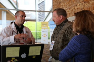
lunch time at #fmeuc what a beautiful view for all this beautiful #fme addicted people pic.twitter.com/hlOi6gTPPs
— Mark Döring (@mcmarkinger) June 10, 2014
FME UC 2014: Day 2
Day 2 of the FME International User Conference 2014 began with a scenic run around the Seawall. The day was full of cutting-edge technology and inspiring data stories from FME users around the world.
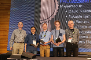
After a delicious breakfast, Don and Dale started the day with a big thanks to the top 5 leaders on FME Community Answers.
Two inspiring keynotes followed.
Autodesk Keynote
Robert Bray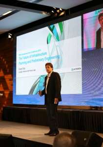 ’s keynote showed off impressive contextual models of L.A., containing unified GIS, CAD, Revit, and point cloud data. He discussed how good transformative solutions offer rich modeling, analytics, and simulation, as well as unified access – anywhere, anytime.
He quipped that they’re simple enough for people who don’t even know how to spell GIS.
Robert discussed digital and physical models, highlighting the physical 3D model of the San Francisco skyline in 2017, which includes 18,000,000 million buildings.
Dale concluded with a mention of the Autodesk user conferences, saying that “Autodesk keynotes stretch our minds to what is possible.”
Hexagon Geospatial Keynote
Bradley C. Skelton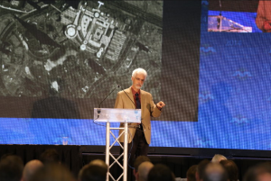 took the stage with a cutting-edge talk on sensor technology. He noted the exciting growth in the number of sensors, resulting in a huge variety and quantity of data.
https://twitter.com/fmeuc/status/476761097987309568
Of course, having a huge amount of data is meaningless unless we do something useful with it. “Data must be analyzed to provide actionable information,” he said. “You need a rich set of GeoSpatial tools that allow you to do all these things.”
He showed off impressive, high-precision point cloud data, moving beyond LiDAR and into SGM technology. He talked about how to exploit 3D datasets with 2D visualization techniques.
He also discussed radar visualization and the incredible future of video sensor technology, showing a sensor video taken from space. He talked about fusing point cloud and raster data, calling it “some of the best change detection I’ve seen.”
https://twitter.com/fmeuc/status/476768211598204928
“Lots of data and many things to do with it,” said Dale. “It’s hard to imagine 20 years from now … even 3 years from now!”
AUTODESK and HEXAGON keynotes at #FMEUC : 4D, sensors, 3D printing, drones, big data… Data, data and more data.
— Ulf Månsson (@ulfme) June 11, 2014
https://twitter.com/fmeuc/status/476768633910071300
Breakout Sessions
If only it were possible to be in 5 conference rooms at once. It’s always fascinating to hear what FME users are up to. Below are just a handful of highlights from today’s 34 breakout sessions. Browse through the #fmeuc Twitter hashtag and/or @FMEUC account for tons of recaps and quotes from all the sessions.
David Eagle talked about optimizing processes at Ordnance Survey. Apparently he came across a 60 MB FME Workspace with nearly 1000 transformers!
Tino Miegel from con terra discussed Python scripting in FME. This talk was so popular, the room filled up.
https://twitter.com/fmeuc/status/476782285820145664
https://twitter.com/fmeuc/status/476787762549366784
FME working with real time ship tracking @exactEarth showcasing a 5 million times a day process #fmeuc pic.twitter.com/r0SmOHlMc3
— The Locationologist (@DARKspatialLORD) June 11, 2014
https://twitter.com/fmeuc/status/476799408634220544
I see dead people in FME. BC Coroners office is using FME to assist in analytics #zombie #fmeuc pic.twitter.com/q2IXTbXfu6
— The Locationologist (@DARKspatialLORD) June 11, 2014
FME delivers lighting strikes to mobile and web. Not meaning the real strike but information about the strike. #FMEUC
— Lassi Tani (@Geolassi) June 11, 2014
Impressive discussion of FME benchmrking test to manage up to 50,000 lightning strike recordings per second #bigdata #dataanalytics #fmeuc
— Spatial Media – GeoTech Education, News & Tips (@SpatialCORE) June 11, 2014
Lightning Talks
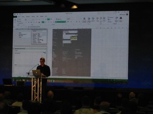
Mikael Månsson from SWECO started off the Lightning Talks with a live demo of a powerful non-spatial data transformation using FME’s Excel writer.
Chris Barrington Brown of Cunning Running gave us a gripping scenario to consider: where is the terrorist located? How can we get the innocent people out and the SWAT Team in? He discussed how an embedded FME instance helps create situational awareness in terrorist and active shooter situations.
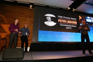
Peter Laulund took the stage next to discuss how GST uses an Atom feed to notify users about new data. He showed how FME reads the feed and fetches data based on criteria. Yes, this was a day full of surprises:
I didn't think I'd ever see Peter Laulund use Workbench! First time for everything… #fmeuc pic.twitter.com/OsQ0sF989E
— Hans van der Maarel (@redgeographics) June 11, 2014
Joanna Hobbins of CAE closed off the lightning talks for the day. She showed an impressive video demo of lightmap overlays for night scenes, and shared a couple of tips on how FME is used to generate these for aeronautic simulation.
Wrap-up & FME World Cup of Data madness
The FME Doctors gave a quick report of the day’s interesting problems, and a couple of great ideas suggested on the FME Idea Board. We take these suggestions seriously – and you heard it straight from FME dev Brittany: “It’s coming!”
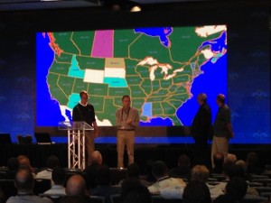
The FME World Cup of Data panel took the stage next. Be sure to make your choice on the poll in the FME UC app, and tomorrow we’ll award the Best Team Name. The panel discussed how FME usage stats have been used to determine the results for this contest, including a few interesting maps showing which formats are used the most around the world.
Interesting turn of events when rowdy XML fan Don took the mic…
@donatsafe takes control of @fmeuc go in about XML flavours #byedon #fmeuc pic.twitter.com/rn7QW2y0Hc
— The Locationologist (@DARKspatialLORD) June 11, 2014
https://twitter.com/fmeuc/status/476873612549304320
Security! Get this guy off the stage!
Tonight we head to Science World for a fantastic evening of dinner and cocktails.
https://twitter.com/Astraelea/status/476875599332380672
FME UC 2014: Day 3
The FME International User Conference 2014 took the party to Science World last night for dinner and cocktails. Having the entire Science World building to yourself is just as fun as it sounds.
FME Dam building 101. @SafeSoftware had a great time at the evening social. #fmeuc pic.twitter.com/VyQgfJMDVN
— SpatialBiz (@spatialbiz) June 12, 2014
Google Keynote
Adam Evans of Google Canada opened by emphasizing the importance of location.
"Maps are the next document type". Google's Adam Evans at #fmeuc Are becoming as everyday as spreadsheets. pic.twitter.com/jyUjXiI47v
— dale_lutz.fme (@DaleAtSafe) June 12, 2014
“51% of companies use web-based mapping services in their business,” he said. He went on to show a few powerful use cases for Google Maps Engine.
He explained how data management in Google Maps Engine is their big problem.
“We’re looking for ways to be interoperable,” he said. “Working with FME is a massive game-changer.”
He showed a simple FME Workspace that simplifies an otherwise complicated transformation in Google Maps Engine. FME allows Google Maps Engine to connect with hundreds of data formats.
Of course, when talking about Google, we’re talking about massive amounts of data. “We collect more data in a week now than we had in our entire archive in 2009.” Google’s partnership with Safe Software is exciting for the future of data interoperability in Google Maps Engine.
Listening to the google keynote, they index the entire internet every 30 mins. WOW! #fmeuc
— Baz (@baznewman) June 12, 2014
FME 2015 and Beyond
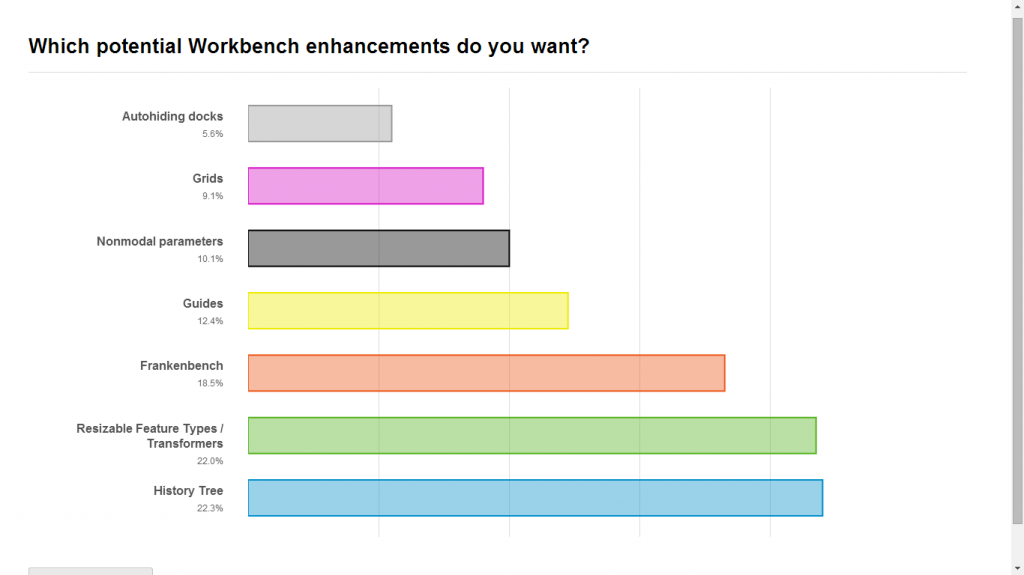
Dale and Don showed some exciting prototype FME functionality. “You’re going to help choose the future of FME today,” said Dale. Attendees voted for their favourite features in the FME UC mobile app.
Functionality included Sharepoint reading, IFC writing, Minecraft writing, Web Services, Web Filesystems, Frankenbench (a Workbench/Data Inspector hybrid application), and a few workbench-specific and reader/writer-specific improvements.
https://twitter.com/fmeuc/status/477130077797240832
https://twitter.com/MapsRus/status/477134464435642369
New PDF options in FME 2015 will be nice for #cartography, looking forward to playjng with it. #FMEUC
— Hans van der Maarel (@redgeographics) June 12, 2014
Usability changes to the FME Workbench interface earned enthusiastic applause:
New feature coming soon to fme – extending the feature type to see the full name #fmeuc pic.twitter.com/7Y4XS6PI7A
— The Locationologist (@DARKspatialLORD) June 12, 2014
“It always amazes me that the smallest things get a clap,” joked Don.
FME Server is getting a few great improvements for 2015, including a major visual overhaul to the web interface.
https://twitter.com/fmeuc/status/477137691373346816
Finally, Don and Dale promised better scalability, reliability, and performance than ever for FME Cloud.
The winning features were determined at the end of the day in a poll:
Look out for the FME Workbench “history tree” in FME 2015!
Breakout Sessions
30 users presented today in the breakout sessions. Like yesterday, be sure to browse through the #fmeuc Twitter hashtag and/or @FMEUC account for recaps and quotes from all the sessions.
Clever Workspace design can cut processing times drastically, from 3 days to 10 minutes on Bruno De Lat's project. Wow! #fmeuc
— Hans van der Maarel (@redgeographics) June 12, 2014
"All your BIM are belong to us": @gschleusner (& @czoog) using FME to flow data between #Revit & #CityEngine #fmeuc pic.twitter.com/Li4XuwuLBy
— dale_lutz.fme (@DaleAtSafe) June 12, 2014
"Virtual" Miso Iric from City of Malmö presenting 3D-printing #fmeuc pic.twitter.com/0MCHbN58Ue
— Ulf Månsson (@ulfme) June 12, 2014
#fmeuc if you are looking for more information about #mapapps and the #fme extension visit http://t.co/XzfFsrOlPV or ask me :))
— Mark Döring (@mcmarkinger) June 12, 2014
Wrap-up, FME World Cup of Data awards, and a Surprise Party
The conference wrapped up with the final match of the FME World Cup of Data, which included a talk from Safer De Wet, who built the FME Cloud-hosted contest website. He explained how FME was used to run the contest and the “matches”, which were FME Workspaces. The prize for the best team name went to The Rasterfarians. Jorge Vidinha (Team GisLX) won the grand prize for the UC pool for his perfect picks. Congratulations!
@FMEDoctors wrapping up all the questions from @fmeuc #fmeuc pic.twitter.com/Z7VUjduy6a
— Permuto (@Permuto_Aus) June 12, 2014
We closed with a Surprise Safe Software Birthday Party and Thank You video, where staff and attendees took the opportunity for a video message to congratulate Don and Dale on 20 years of Safe Software and thank them for everything they’ve done.
what a wonderful and emotional closing session #fmeuc we really love this wonderful #FME family #thankyou all pic.twitter.com/JIbARu68Nn
— Mark Döring (@mcmarkinger) June 12, 2014
Some of the greatest guys out there #fmeuc pic.twitter.com/pF7apHIDhr
— The Locationologist (@DARKspatialLORD) June 12, 2014
Wow, a very inspiring end to #fmeuc @fmeuc – knocked it out of the stratosphere, @DaleAtSafe @donatsafe !! pic.twitter.com/5ir75ZOnIg
— Mark A Giesbrecht (@geographicus97) June 12, 2014

