The Why of BIM to GIS: George Washington’s Mount Vernon


Esri, Mount Vernon, and Quinn Evans Architects collaborate on a blended BIM-GIS 3D world with the assistance of the FME-based ArcGIS Data Interoperability Extension – and provide project stakeholders with an incredibly detailed view of site and structure data and history for planning and maintenance. In a web browser!
BIM and GIS interoperability is a hot – and often polarizing – topic these days. Some think it’s a great idea, some think it’s a crazy idea, and others are scratching their heads and thinking, “cool, but why on earth would you do that?”
Well, today I’m going to show you a project that answers that last question quite nicely, and how they did it.
Creating an Historical Building Information Model – HBIM
 Historical preservation is anything but old-fashioned when it comes to technology.
Mount Vernon partnered with Quinn Evans Architects and Esri to build out a tool that would bring together the rich detail of BIM with the spatial context of GIS, and make the whole thing accessible to anyone working on the site – not just application-specific experts.
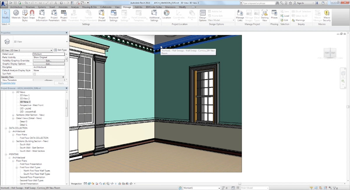
They started by laser scanning the exterior, interior, and crawlspaces of the mansion, and Quinn Evans ultimately generated an architectural-quality model in Autodesk Revit. The model also contains a wealth of minute detail, documentation and history about the maintenance and preservation of the structure going back almost 300 years.
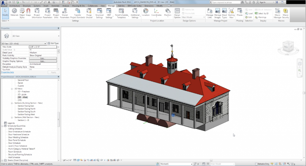
Revit, for the unfamiliar, is a highly specialized and technical application much used by architects. And this level of detail, whether documenting an existing structure or designing a new one, is one of the things it is great for. But since most of us don’t have a copy on our computers (and I know I’d barely know where to start if I did), the next stage of the collaboration is where things start to get exciting.
ArcGIS, Data Interop, and IFC: How to Make a Blended 3D World
Mount Vernon itself is more than just a mansion. It’s an estate, with numerous outbuildings, and teams devoted to the structures and the grounds. And so it made sense to blend the numerous rich datasets into one seamless world. The most logical platform for that was Esri’s ArcGIS. Patrick Gahagan, Solutions Engineer at Esri, took on the challenge of figuring out how to get the BIM model incorporated, complete with attribution.
Esri’s FME-based Data Interoperability Extension adds a host of additional format support to ArcGIS. One of those formats is Industry Foundation Classes (IFC) – an internationally recognized open standard for sharing BIM data. And though IFC reading had been in place for some time, the Mount Vernon project pushed the limits, and resulted in a number of enhancements.
In early 2014, we released an add-in for Revit and new support in the Data Interoperability Extension for reading the archive generated by this new tool. The underlying format is what we call IFC++ – IFC plus a bunch of other goodies to make translations as complete as possible.
The workflow begins in Revit where coordinates are added and the rotation from project north (preferred by designers) to true north (its real orientation) is entered. With the BIM content geo-referenced, the FME export tool is run and the schedule information is exported to a spreadsheet.
The data is then imported into ArcGIS and connected back to the attribution via Data Interop.
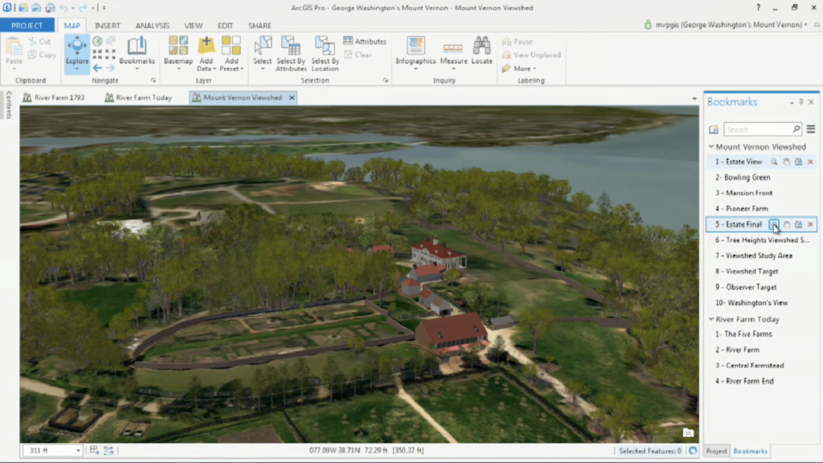
As you can see here in ArcGIS, the blended world includes 3D models, the HBIM of the mansion, LiDAR-derived vegetation, and more.
But Why Would You Build One?
It may not be immediately obvious why you would want to go to all of this effort. While it’s undeniably cool, what do you do with it?
Viewshed Analysis
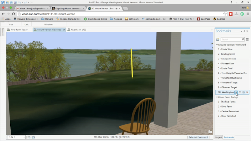
Have a fully integrated 3D representation enables a variety of contextual analyses. For Mount Vernon, one of the more important ones is viewshed analysis – ensuring that the vista across the Potomac River remains pristine.
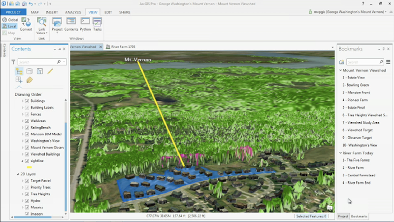
As you can see in this example with LiDAR canopy data overlaid, a new development across the river is shielded from view by specific trees (in pink) – identified with a viewshed analysis in ArcGIS. With such specific identification, they were able to make arrangements to keep those intact, and so preserving the view from the verandah much as it would have been in Washington’s day.
Structure Maintenance and Planning
Performing analyses outside the building is of great value, but it’s inside the mansion where we really see the power of unlocking the BIM data.
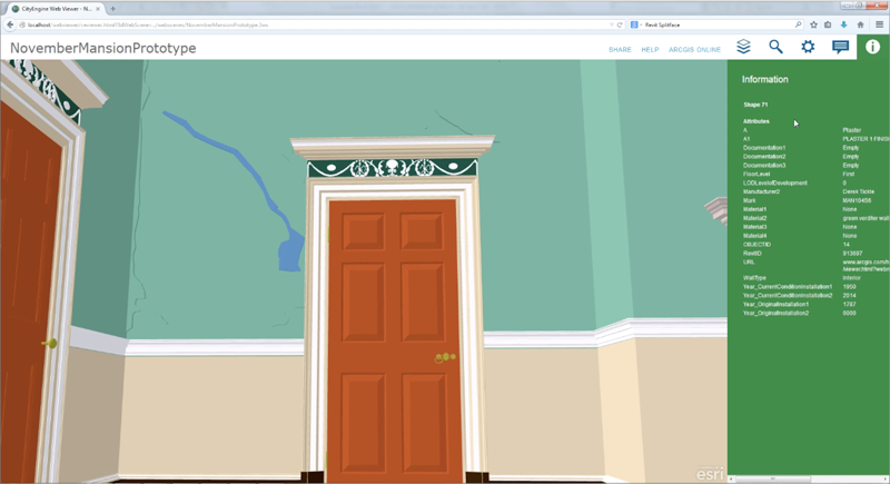
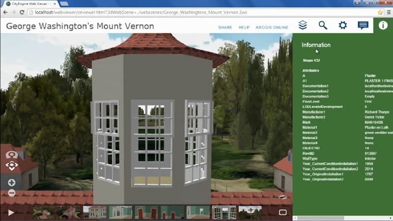
The real key here is having the attributed model available to any stakeholder – GIS user or not, Revit user or not – in a web browser.
An upgrade to the fire suppression system is planned for the mansion. With the BIM data, anyone involved in the project can see not just context, but structural and historical details – as detailed as where and when plaster was repaired on a wall. And when designing the new installation, the age and condition of 1950 plaster versus 1787 plaster makes a big, big difference.
With the architectural detail extending even past where the eye can see, designers can examine the location of framing and structural elements to minimize the impact and effectively route the new system.
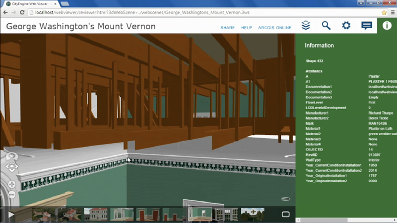
This web interface to the integrated world, made possible by BIM-GIS integration, brings a wealth of data, previously locked up in specialized systems, to each and every stakeholder that can benefit from it.
What could this mean for more mainstream projects?
We certainly don’t all get to work on such iconic structures as Mount Vernon! But the methodology here is eminently transferable to any project where multiple stakeholders can benefit from access to BIM data and spatial site context – be it an airport, an industrial park, or a high-rise. New construction, maintenance – if the data exists, it might be worth your while to see if you can leverage it in new ways like this.
Since George Washington was a surveyor and mapmaker himself, I suspect he would highly approve.
Want to learn more?
Watch 3D Mount Vernon as presented at the 2015 Esri Federal GIS Conference
Esri: ArcGIS Data Interoperability
FME Knowledge Center: 3D Resources (including IFC)
Blog: The State (+ Future) of BIM and GIS Interoperability


