5 ways to view your augmented reality data (with examples!)
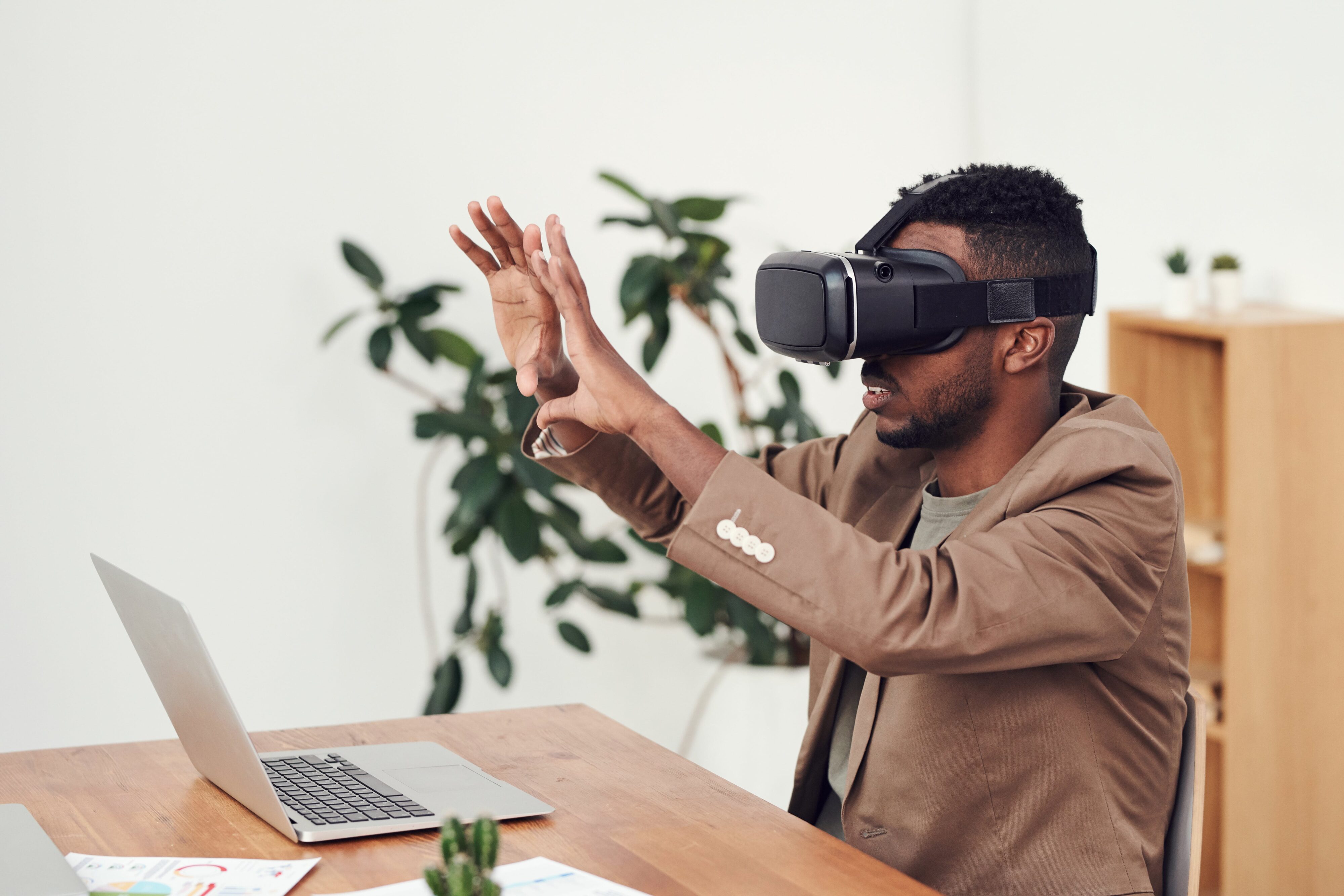

Augmented reality is no longer exclusively used by just the tech experts.
Augmented reality (AR) is an interactive way for users of (most often) handheld devices to see the world before them with additional objects, information, or data displayed. It’s the ability to transform your reality. This differs from virtual reality (VR), where users are completely immersed and “transported” to a new environment. And, of course, there are ways to intermix these two experiences to create what’s known as mixed reality.
It’s safe to say that our ability to investigate, understand, and sometimes even play with data is no longer limited to the 2D world of our computer screens. AR is easier to make use of than ever, especially because there integration tools that allow you to combine different components of different datasets to create the exact output you need.
The examples below highlight innovative ways you can use data you likely already have available in AR (and if don’t have any, there are plenty of open-source resources for data!) You’ll soon realize that transforming your data for augmented reality really isn’t that difficult.
(Psst… Have specific AR questions? Sign up for the webinar “Ask Me Anything: Transforming Data for Augmented Reality“)
1. Location-Based Asset Labelling
There is a lot of updates to #FMEAR by @SafeSoftware, but IMO, the most important ones are scale 1:1, geolocation, and the use of compass – now #AR models can really augment the reality with no manual adjustments. This model is created with location taken from FME Data Express. pic.twitter.com/hoXzdux2PE
— Dmitri Bagh (@DmitriAtSafe) December 6, 2019
When we’re moving through spaces, indoor or outdoor, we often rely on metadata in the form of signage to better understand where we are and what’s around us. But, the amount of information we’re able to obtain is limited by the amount of physical space available. With augmented reality, you don’t have that issue.
It’s similar to audio tours. You’re able to both view your surroundings and learn more simultaneously. However, with audio tours, you solely rely on the words being spoken to determine what to observe. With augmented reality, you can directly see what information relates to specific real-world objects.
Integrating spatial coordinates alongside descriptive information about locations is the perfect use case for simple, real-world augmented reality scenarios.
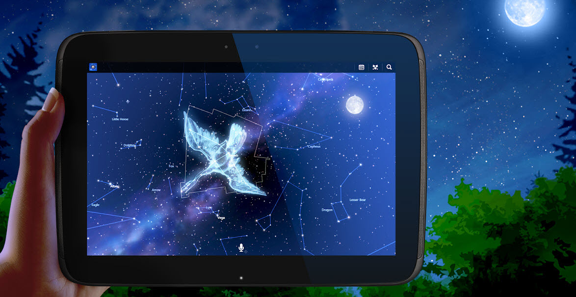 A Reality Out of This World
Not a die-hard astronomy fan? No worries! Apps like Star Chart use your location and details about the stars above to present real information in real time. Now you can both observe the beauty of space while learning a bit more about what’s out there.
2. Create Wayfinding Apps for Indoor Navigation
Our ability to navigate the outdoors is incredible. But, these days, many of us spend our time navigating indoor environments. And, with each new building we visit comes a totally different environment to explore.
Using augmented reality indoor mapping in places like airports, hospitals, or arenas is an easy way to help people get from A to B and display relevant information about their surroundings along the way. And, when people can easily find what they’re looking for, their experience and perception of your venue become increasingly positive.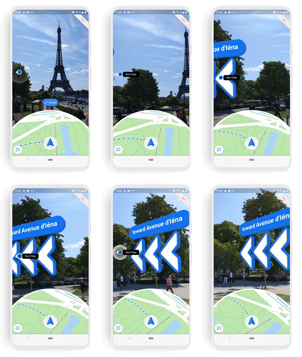
What’s even better about an AR map versus an on-screen map is that you can look through your mobile device and see both where you’re going and what’s happening around you. There’s no need to keep your head down, so you can always be completely aware of your surroundings.
This is a great way to integrate and reuse your CAD or BIM data in an AR world. By creating simple workspaces that transform your data into an AR compatible format, you’ll be able to help guests find their destination in no time.
Augmented Reality Wayfinding Outdoors
While not an indoor example, Google’s Live View demonstrates how augmented reality can be used for navigation purposes. Try it out yourself and see what inspiration you can draw before making your own app!
3. Visualize What’s Underground
Why didn’t I try textures on #AugmentedReality utility pipes before? Here is a simple comparison made with #FME #AR app. I think textures add a lot – a better visibility of shapes and joints, and it’s easier to estimate distances. Do you agree? @SafeSoftware pic.twitter.com/QDKsafkLwj
— Dmitri Bagh (@DmitriAtSafe) July 31, 2020
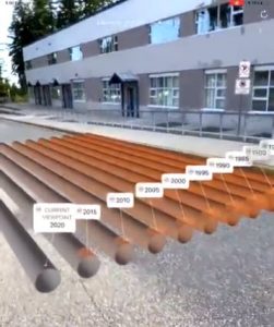
In some ways, augmented reality enables you to have superpowers. X-ray vision, anyone?
Seeing what’s behind or below a surface in the real world instead of on a screen can help users plan, prepare, and be more efficient in their decision making. Rather than checking back with blueprints and notes, you can look through a device to see what’s beyond the surface directly where you stand.
You can even integrate data like utility lines with textures to display more information, such as how old different pipes are. This sort of visual communication is a great way to say more with less.
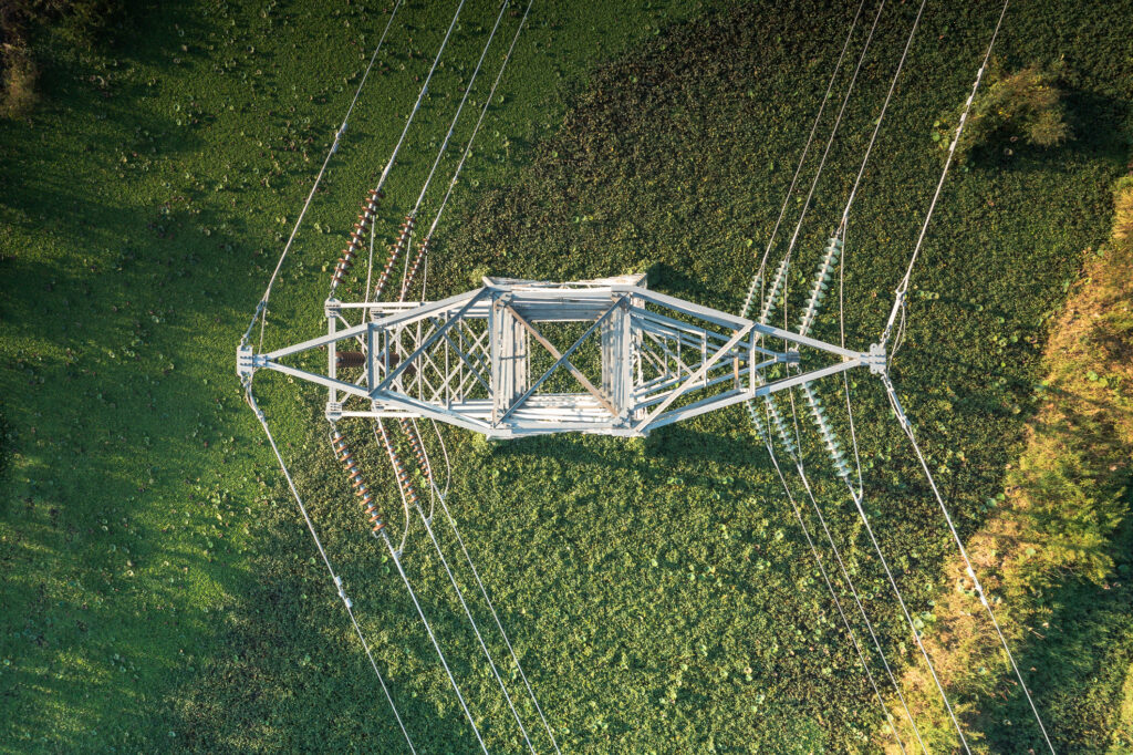
Augmented reality is the perfect technology for displaying utility networks underground to aid in “one call” or “dial-before-you-dig” services for local governments and other utility providers.
Augmented Reality X-Rays
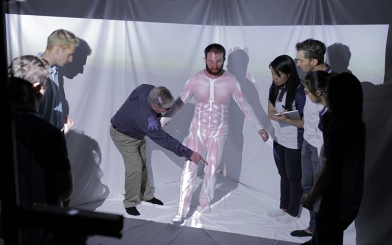
Speaking of X-rays, AR is being used to understand the inner workings of our bodies better. Researchers at the University of Melbourne have been using augmented reality for physiotherapy education to show anatomical information like muscles and skeleton in real-time. AR supported environments have proven to be a great way for instructors to teach and students to observe and learn more effectively.
4. Display 3D Models
Printed #townplanning proposal to #3d with #AugmentedReality. Thanks @SafeSoftware #FME2018 pic.twitter.com/PruzI9Ujxr
— Eetu Lappalainen (@EeduLappalainen) March 15, 2018
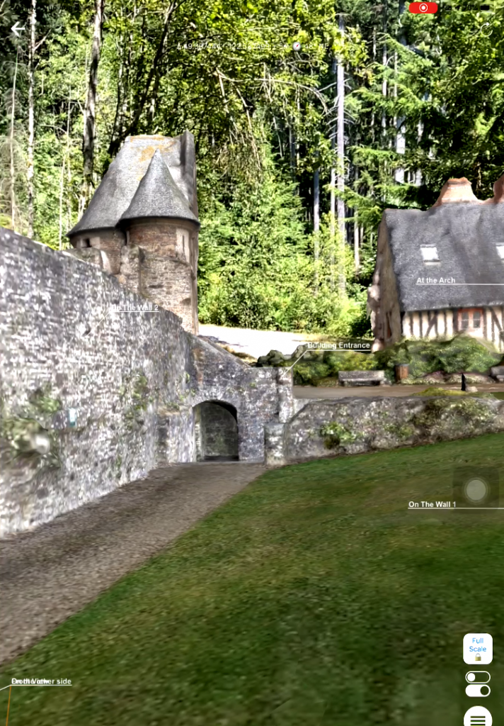
I think we can all agree that 3D models are a much more fascinating and fun way of learning about data that simulates objects in the real world. However, our ability to make use of 3D models has been limited by the technology available. With augmented reality and how accessible it has become, that limitation has begun to fade.
By visualizing plans in advance for things like construction and development, users can easily identify issues, saving time and money in the long run. It’s also an engaging way to present ideas to stakeholders who help in the decision-making process.
Use your creations or those of others to place objects in the real world. Whether it’s just for fun, to visualize changes to your surroundings, or to teach others of the past with historical sites, augmented reality can take you one step further.
Model by noxfcna via Sketchfab
Become an Interior Decorator
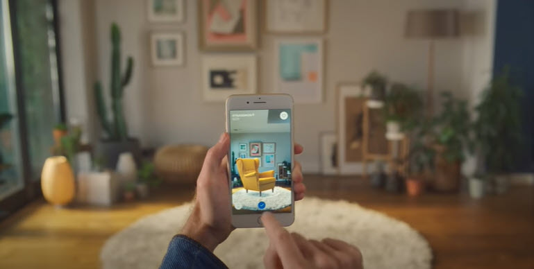
Ikea has made choosing furniture for your home easier with their augmented reality app. Simply select your item of interest from their catalogue, then “place” it in your room and see what you think. With all items being placed to scale, you’ll be able to visualize exactly how your interior will look before committing to a purchase. This is a great real-world example of how 3D models and augmented reality can help customers.
5. Exploring New Environments (Mixed Reality)
Ever wanted to go somewhere you’ve heard about and seen pictures of, but never could? Well, augmented reality is your round-trip ticket to that destination. This is a great project to begin experimenting with mixed reality — where AR and VR are used simultaneously to both “transport” a user and transform their environment.
Create the environment of your choice and choose the viewpoints for your user to experience your creation from. This is the perfect way to simulate what it may “feel” like to navigate an environment that doesn’t yet exist. For example, how a hospital worker may move through a ward and access various supplies. It’s another way to identify issues before investing the time and money to build these facilities in real life.
Using AR to access an environment far different than your own quickly is an excellent way to demonstrate what life is like elsewhere. But most of all, it’s a ton of fun (check out how we turned our lunchroom into a Mario Kart track!)
Racing in Place
To promote the Acura TLX, the “What a Race” event was streamed online. This event showcased the first-ever augmented reality car race where drivers would race through jungles, glaciers, and volcanoes. This was both an extremely creative and technologically advanced way to use mixed reality for a virtual event.
As you can see, augmented reality gives you the ability to free your data into (quite literally) a new dimension. By integrating data from multiple sources and transforming all of it into an AR compatible format, you can leverage the power of your data. There are so many ways to do more with data you already have. And now, with apps like FME AR, innovative solutions are at your fingertips.
If you’re wanting to play around more with your data and augmented reality, check out FME AR, the free FME mobile app for viewing your data in augmented reality. And if you need help with anything, feel free to post in the FME Community or tweet at our resident AR expert, Dmitri Bagh (or, just leave him a comment below!)
Not an FME user? No worries. Download the trial and then check out “Getting Started with FME AR” to start your journey!
And, sign up for the webinar “Ask Me Anything: Transforming Data for Augmented Reality” to get all your questions answered.

